Official routes retain land-manager provenance, vehicle rules, and season information.
Know the trail.
Find your crew.
Ride farther.
TrailLink puts sourced ATV and OHV destinations, official motor-vehicle routes, GPS ride recording, and your riding groups in one field-ready app.
Android 7.0+ · Build 1 · SHA-256260ff6b9d0b3e848…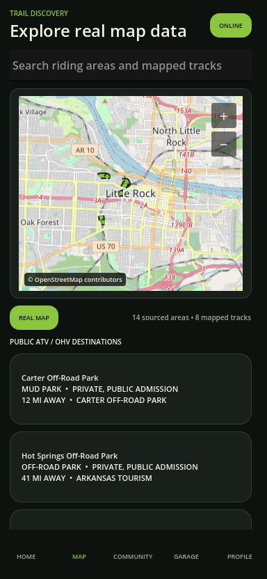
OFFICIAL DATAUSDA MVUMVehicle rules + seasons
RIDE WITH CONTROLPrivate by defaultShare only when you choose
The context you need when the pavement—and the signal—ends.
TrailLink keeps legal-use metadata separate from the visual basemap. Every official route shows its source, permitted vehicle classes, and published season information.
GPS breadcrumb recording and queued ride sync continue when cell service disappears.
Group location sharing requires explicit opt-in and expires automatically.
Put TrailLink on your phone.
Android testers can use a signed beta package when it is published. iPhone testers can register now for the future TestFlight group.